Crews will begin clearing vegetation along Interstate 280 near Page Mill Road the week of Monday, Sept. 21. The work will bring periodic weekday lane closures to the freeway corridor through summer 2027.
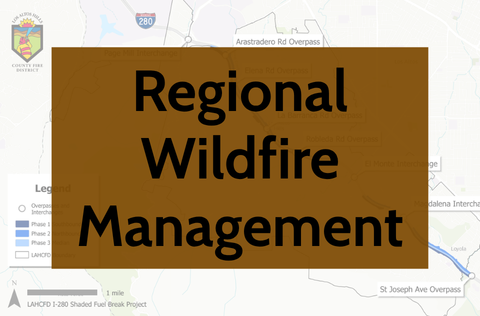
The I-280 Shaded Fuel Break Connectivity Project stretches from the Page Mill Road interchange south to the St. Joseph Avenue undercrossing. The Los Altos Hills County Fire District (LAHCFD) is leading the effort in coordination with Caltrans, Palo Alto and other regional wildfire partners, according to a city announcement published Monday, Sept. 14.
Drivers should expect shoulder and lane closures along the corridor, generally Monday through Friday, 9 a.m. to 3 p.m., while work is underway.
The project aims to reduce hazardous roadside vegetation on both sides of the freeway and the center divide, strengthening evacuation and emergency-access routes in the fire-prone foothills. At its northern end, the corridor abuts Stanford and Palo Alto-managed lands.
Phase 1 is estimated to finish around Nov. 23, according to the LAHCFD project page. The full project will continue in phases through summer 2027. The fire district's project description estimates approximately 152 treatment acres across the corridor. The work will create a continuous shaded fuel break connecting to an existing regional network covering Palo Alto, Cupertino and Los Altos.
Biological surveys began along the corridor Sept. 14, ahead of the vegetation removal.
The project builds on a smaller effort completed in March at the Page Mill Road/I-280 interchange. That earlier project, coordinated by LAHCFD, the City of Palo Alto and the Santa Clara County FireSafe Council, treated roughly 35 acres and 5.86 miles of roadside, according to the FireSafe Council's project page.
Phase 2 dates have not been announced. Residents can sign up for project updates through the city's website.